Context of the project
The protection of water and soil resources is the subject of two agricultural and environmental policies at European level:
- the Common Agricultural Policy through the post-2020 CAP Strategic Plan (good agricultural and environmental conditions in terms of soil protection, as part of the cross-compliance of agricultural aid);
- the Water Framework Directive, which includes the Program for Sustainable Nitrogen Management in Agriculture (PGDA) and the Walloon Pesticide Reduction Program (PWRP).
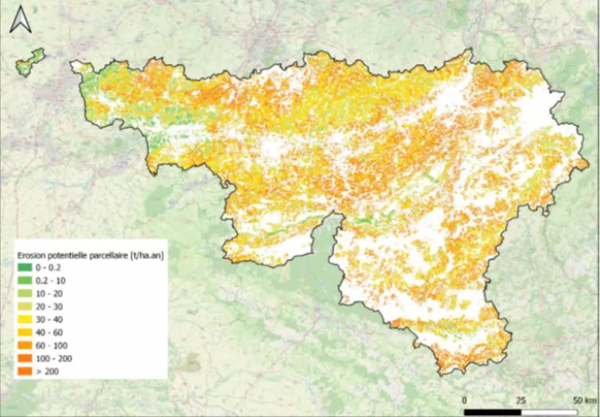
However, to be able to implement targeted measures to mitigate agricultural soil erosion and the transfer of agricultural pollution to surface water via runoff, up-to-date mapping data is necessary. In this framework, the present project has provided cartographic management tools for the application of established water and soil protection standards, as well as online simulation tools accessible in partnership with the University of Liège and the University of Louvain.
As part of this assignment, SHER Ingénieurs-Conseils undertook the following activities:
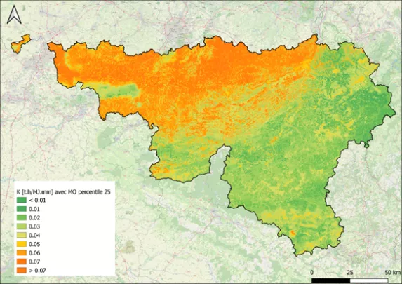
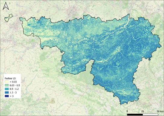
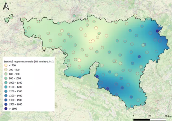
- Update of the baseline cartographic data products used to calculate soil erosion (rainfall erosion, soil erodibility, topographic factor considering various inter-parcel hydrological connectivity scenarios).
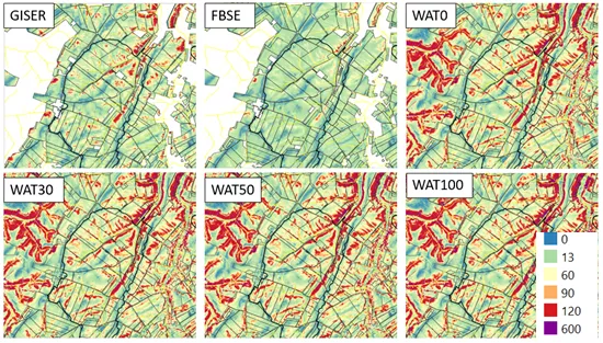
- Mapping of erosion risk and development of a tool for dynamic calculation of erosion sensitivity class.
- Correlations between calculations, EPICgrid model results and field data and development of hydrological and sediment connectivity indices at watershed scale.
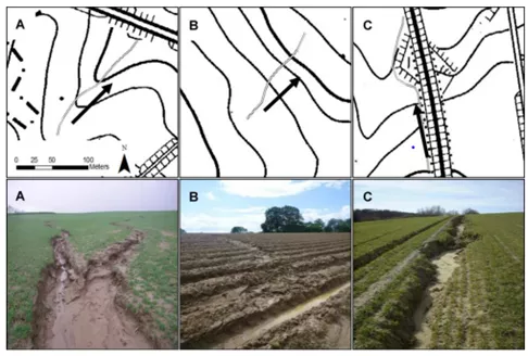
Project images