Context of the project
In collaboration with Acacia Water (hydrogeology and geophysics), the project aims to improve access to drinking water for populations affected by drought in Kenya and Somalia. The project will locate high potential groundwater zones in drought prone areas. The produced maps should serve as a basis for national stakeholders for successful groundwater development and improved success rate of borehole drilling.
As part of this mission, SHER Ingénieurs-Conseils and Acacia Water undertake the following activities:
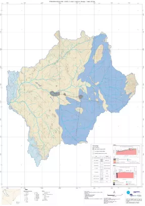
- Collecting existing data to produce a hydrogeological map for each cluster
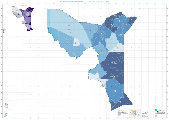
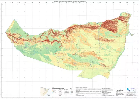
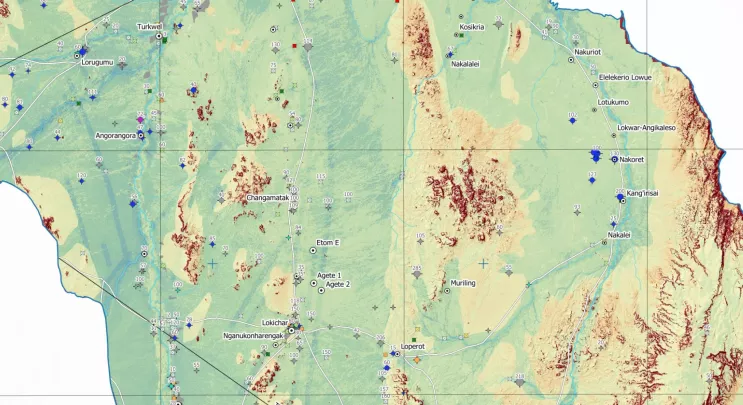
- Conducting remote sensing and GIS analysis to develop groundwater potential maps at scale 1:100,000 and to classify groundwater prospection zones in each investigation area
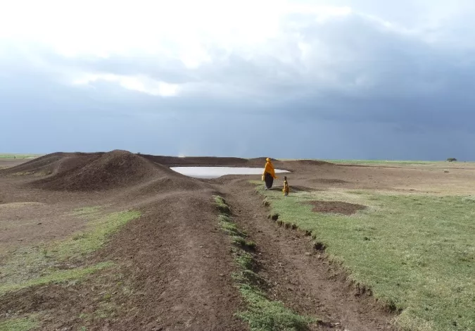
- Carrying out detailed, site specific hydrogeological and geophysical studies to identify optimal borehole drilling sites
- Conducting capacity building of national counterparts (governments, NGO partners and other stakeholders) to use overlay analysis techniques for groundwater potential mapping, including satellite data analysis and interpretation and disseminate the underground water mapping resources and products among key WASH stakeholders
- Supporting the development of a WebGIS for the mapping products (geological, socio-economic, water demand, groundwater potential maps, etc), as well as the reports and the methodology, in collaboration with the UNICEF Regional Office.
- Collaborating with UNICEF to publish a peer-reviewed academic paper/article
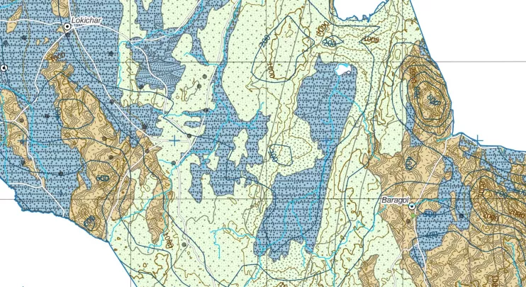
In phase 2, currently under way, hydrogeological and geophysical studies are being carried out by our local partners. Our team of mapping experts are in charge of processing the field data and producing detailed hydrogeological maps (at a scale of 1:50,000) as well as maps of sites suitable for drilling (at a scale of 1:15,000).
Project images