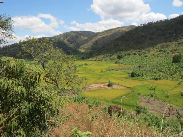
Geomatics and topography play a crucial role in the collection, analysis and dissemination of spatial data. They are therefore a fundamental pillar of SHER’s projects.
Spatial data collection and processing
Geomatics, combining expertise in geography, mapping and IT, ensures the collection, the analysis and the dissemination of spatial data. Our topography specialists use a range of techniques to acquire data, enabling the creation of plans and 3D models.
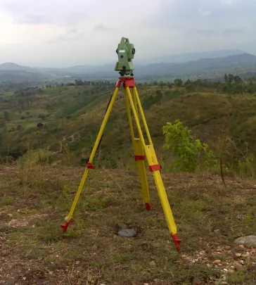
Topography and bathymetry: teams and equipment for your projects
For over twenty years, SHER has been carrying out complete topography studies as part of our projects, using cutting-edge technologies such as remote sensing, photogrammetry, LIDAR and GPS positioning. Our team is involved in 3D modelling, the implantation of infrastructure and site supervision.
Geomatic solutions for informed decision support
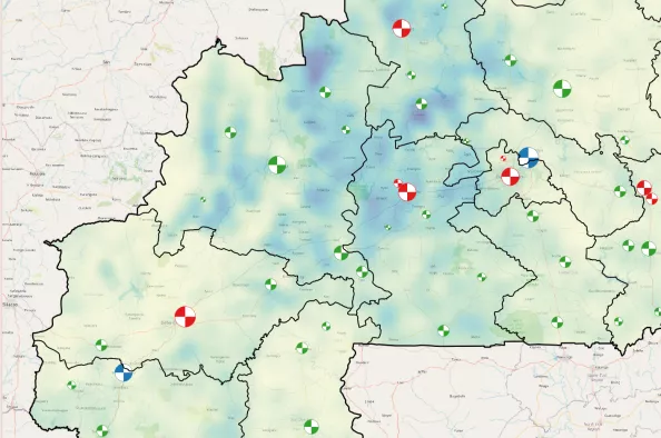
SHER’s projects are based on the use of Geographic Information Systems (GIS) and spatial data. This data, collected at various stages of the project, is used in Information Systems, whiwh are fundamental decision-making and communication tools.


Interdisciplinary and integrated project approach
Our expertise in geomatics and engineering guarantees solutions customised to each phase of your project. We design geomatic solutions for drinking water, sanitation, agriculture, water and soil management, clean energy, climate resilience and biodiversity. We integrate our technologies in a scalable and sustainable way, and offer you customised training and a rigorous quality control.
SHER offers a comprehensive range of geomatic services, from needs analysis to the implementation of solutions. We develop integrated solutions to ensure the excellence of your projects.
Our geomatic and topographic surveying services
Data collection and processing
- Topographic data acquisition: total stations, 3D scanners, DGPS, drone, bathymetric, echo sounder
- Field data acquisition
- Vectorisation of paper maps
- Data conversion, enrichment and validation
- Implementation of Open and Big Data solutions
Spatial databases
- Design of spatial databases - local or online
- Database development
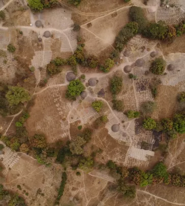
Earth Observation / Remote Sensing
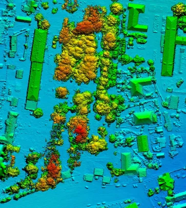
- Acquisition of satellite imagery and Digital Terrain Models (DTM)
- UAV based image acquisition
- 3D modelling and UAV photogrammetry
- Image classification: land cover and land use, vegetation indices, change detection
Geographic Information Systems (GIS) and mapping
- Setting up GIS
- Spatial analysis - multi-criteria
- Creation of 2D/3D thematic maps
- Map and atlas production
Web and mobile applications
- Customized desktop tools
- WebGIS and mobile GIS applications
- Reporting and dashboards for decision support
Training and support
- Use of GIS tools
- Use and administration of WebGIS applications